
Export data
ORBAT Mapper can export units and features to the following data formats:
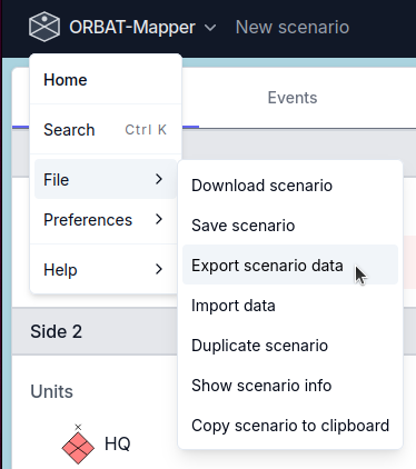
Start the export process
To start the export process select Export scenario from the File menu.
GeoJSON
GeoJSON is a popular open standard format for representing simple geographical features, along with their non-spatial attributes.
KML
KML (Keyhole Markup Language) is an XML-based format used to display geographic data in mapping applications such as Google Earth. Exporting to KML makes it easy to share and visualize your scenario data in widely used geospatial tools. For more information, see the KML documentation.
XLSX
MilX
ORBAT Mapper has experimental support for exporting a scenario as MilX layers for use with map.army.
WARNING
Please note that ORBAT Mapper only supports a small subset of the MilX format. A major compatability issues is that Map.army uses letter based MILSTD 2525C/APP6-C symbol codes. Conversion from 2525D/APP6-D to 2525C/APP6-C is not always possible. ORBAT mapper will try to find the closest matching symbol, but this process may fail.